Ditch 46
Project #20
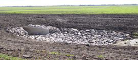
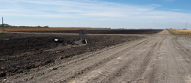
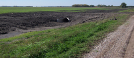
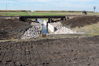
After establishment of Project 17, the SHRWD received a petition to add an additional system further upstream. The SHRWD’s investigation eventually led to the establishment of Project 20 in 2006. Project 20 consists of an improvement to a portion of Polk County Ditch 46. County Ditch No. 46 is made up of two segments, the Main and the Branch. The upstream end of County Ditch No. 46 Main (CD 46 Main) is located in the NE quarter of Section 3, T147N, R46W (Reis Township). From there, the ditch drains west approximately 13 miles where it outlets into the Sand Hill River. CD 46 Main was improved starting in the NE corner of Section 5, T147N, R46W (Reis Township). In this location, a ditch block was installed that diverts runoff into the Sand Hill River Watershed District Project No. 17 Diversion Ditch. The Project No. 17 ditch serves as the primary outlet for this project. An overflow spillway was installed in the CD 46 Main ditch block to allow water to overflow into the existing County Ditch No. 46 system during extreme runoff events. The County Ditch No. 46 Branch (CD 46 Branch) begins in the NE corner of Section 5 where it outlets into CD 46 Main. Moving upstream from there, CD 46 Branch proceeds southeast for approximately ¼ mile along the west side of the Minnesota Northern Railroad before turning and proceeding south along the west side of Section 4 to the NW corner of Section 9. The ditch then turns and heads east approximately ½ mile before turning south and following the north-south ¼ line of Section 9 to the north ¼ corner of Section 16. At this point, CD 46 Branch again turns and heads east for approximately 2.5 miles where it terminates in the NE corner of Section 14, Reis Township. As part of Project 20, CD 46 Branch was extended 3 miles to the east to the NE corner of Section 17, T147N, R45W (Liberty Township). A ditch block was installed at the upstream end of County Ditch No. 73 in Section 9, T147N, R46W (Reis Township) to prevent CD 46 Branch flows from being diverted into this system under most runoff situations. An overflow section was also installed in the County Ditch No. 73 ditch block to allow water to overflow into the existing County Ditch No. 73 system during extreme runoff events. The overflow elevation was set to the 100 – year flood elevation in the Branch.
-
Benefit Area:
The average cost is $50-$60 per acre and was spread over 20 years beginning in 2007. To download the benefit area map, click here.
-
Project Costs:
Under construction - check back soon!
-
Recent Ditch Inspection Report:
Surveyors and ROW marker installers put up signs replacing missing markers along all of the ditch ROW. Signs were be placed every ¼ mile so they are easily seen. Check back soon for 2017's recent ditch inspection report.